Comté de Wetaskiwin No 10

Cet article est une ébauche concernant l’Alberta.
Vous pouvez partager vos connaissances en l’améliorant (comment ?) selon les recommandations des projets correspondants.
| Comté de Wetaskiwin No 10 | ||
 | ||
| Administration | ||
|---|---|---|
| Pays |  Canada Canada | |
| Province |  Alberta Alberta | |
| Région | Alberta central | |
| Statut municipal | district municipal | |
| Maire | Kathy Rooyakkers | |
| Constitution | 1958 | |
| Démographie | ||
| Population | 10 866 hab. (2011) | |
| Densité | 3,5 hab./km2 | |
| Géographie | ||
| Coordonnées | 52° 58′ 10″ nord, 113° 22′ 37″ ouest | |
| Superficie | 312 940 ha = 3 129,40 km2 | |
| Divers | ||
| Fuseau horaire | UTC-7 | |
| Code géographique | 4811001 | |
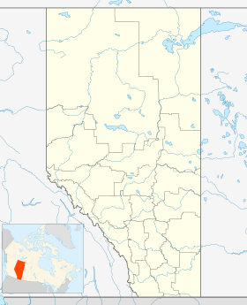
| Localisation | ||
| Géolocalisation sur la carte : Alberta
| ||
| Liens | ||
| Site web | www.county.wetaskiwin.ab.ca | |
modifier  | ||

Le comté de Wetaskiwin No 10 (anglais : Wetaskiwin County No. 10) est un district municipal de 10,866 habitants en 2011, situé dans la province d'Alberta, au Canada.
Communautés et localités
- Millet
- Villages d'été
- Argentia Beach
- Crystal Springs
- Grandview
- Ma-Me-O Beach
- Norris Beach
- Poplar Bay
- Silver Beach
- Hameaux
- Alder Flats
- Buck Lake
- Falun
- Gwynne
- Mulhurst Bay
- Village at Pigeon Lake
- Westerose
- Winfield
- Localités[1]
- Aspen Acres
- Battle Lake
- Beachside Estates
- Bevan Estates
- Brightview
- Curilane Beach
- Diana
- Fairview Heights
- Fraspur
- Ganske
- Grandview Heights
- Knob Hill
- Lakeland Estates
- Lakeside Country Estates
- Lansdowne Park
- Larch Tree Park
- Malmo
- Maywood Bay
- Maywood Subdivision
- Modest Creek Estates
- Mullen Dalf
- Norbuck
- Nordic Place
- Patience
- Peace Hills Heights
- Peace Hills Park
- Pendryl
- Pineridge Downs
- Pipestone
- Prestone Village
- Springtree Park
- Texaco Bonnie Glen Camp
- Thompson Subdivision
- Town Lake
- Usona
- Viola Beach
- Wenham Valley
- Willowhaven Estates
- Wizard Heights
- Yeoford
Démographie
| 2001 | 2006 | 2011 | 2016 |
|---|---|---|---|
| 10 695 | 10 535 | 10 866 | 11 181 |
Sources : Statistiques Canada 2006[2] Statistiques Canada 2016[3]

Références
- (en) Cet article est partiellement ou en totalité issu de l’article de Wikipédia en anglais intitulé « Wetaskiwin County No. 10, Alberta » (voir la liste des auteurs).
- ↑ « Wetaskiwin County No. 10, codes géographiques et localités, 2006 », sur Statistique Canada (consulté le ).
- ↑ « Statistique Canada - Profils des communautés de 2006 - Wetaskiwin County No. 10, MD » (consulté le )
- ↑ « Statistique Canada - Profils des communautés de 2016 - Wetaskiwin County No. 10, MD » (consulté le )
Annexes
Articles connexes
Liens externes
- Site officiel
v · m | ||
|---|---|---|
| Subdivisions |
|  |
| Communautés |
| |
| Cités et secteurs de services urbains |
| |
| Régions | ||
Subdivisions de :
| ||
 Portail de l’Alberta


