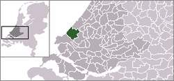
Wateringen
Place in South Holland, Netherlands

Flag

Coat of arms
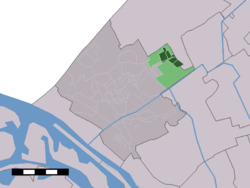
The village (dark green) and the statistical district (light green) of Wateringen in the municipality of Westland.
Wateringen is a town in the Dutch province of South Holland. It is a part of the municipality of Westland, and lies about 5 km southwest of The Hague.
Until 2004 it was a separate municipality and covered an area of 8.93 km2.
The former municipality of Wateringen also included the town Kwintsheul.
The village of Wateringen has a population of around 10,860.[1] The statistical area Wateringen, which also can include the surrounding countryside, has a population of around 13,880.[1]

Gallery
-
 windmill: molen de Windlust
 -
 church in the street
 -
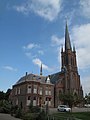 church: Sint Jan de Doperkerk


References
- ^ a b Statistics Netherlands (CBS), Statline: Kerncijfers wijken en buurten 2003-2005. As of 1 January 2005.
External links
- Municipality of Westland (in Dutch)
Authority control databases | |
|---|---|
| International |
|
| National |
|
| Geographic |
|
- v
- t
- e


