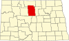
Land Township, McHenry County, North Dakota
Land Township is a civil township in McHenry County in the U.S. state of North Dakota. As of the 2000 census, its population was 48.[1] The population in 2009 was estimated at 42.[2] The township was organized in 1907.[3]
References
- ^ U.S. Census Bureau. Census 2000. "Census Demographic Profiles, Land Township" (PDF). CenStats Databases. Retrieved January 31, 2009.
{{cite web}}: CS1 maint: numeric names: authors list (link)[dead link] - ^ U.S. Census Bureau (2010). "Incorporated Places and Minor Civil Divisions: North Dakota". 2009 Population Estimates. Archived from the original (CSV) on June 27, 2010. Retrieved June 22, 2010.
- ^ U.S. Census Bureau (1913). "Number of Inhabitants, North Dakota" (PDF). Thirteenth Census of the United States: 1910. Government Printing Office. Retrieved July 20, 2008.
- v
- t
- e
Municipalities and communities of McHenry County, North Dakota, United States
County seat: Towner
- Anamoose
- Balfour
- Bantry
- Berwick
- Bjornson
- Brown
- Cottonwood Lake
- Deep River
- Deering
- Denbigh
- Egg Creek
- Falsen
- Gilmore
- Granville
- Grilley
- Hendrickson
- Karlsruhe
- Kottke Valley
- Lake George
- Lake Hester
- Land
- Layton
- Lebanon
- Little Deep
- Meadow
- Mouse River
- Newport
- Normal
- North Prairie
- Norwich
- Odin
- Olivia
- Pratt
- Riga
- Rose Hill
- Round Lake
- Saline
- Schiller
- Spring Grove
- Strege
- Velva
- Villard
- Voltaire
- Wagar
- Willow Creek
territory
- East McHenry
- Northeast McHenry
communities
‡This populated place also has portions in an adjacent county or counties
- North Dakota portal
- United States portal
47°52′00″N 100°32′02″W / 47.86667°N 100.53389°W / 47.86667; -100.53389
 | This North Dakota location article is a stub. You can help Wikipedia by expanding it. |
- v
- t
- e


