Dolič, Destrnik
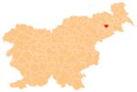
Place in Styria, Slovenia
46°29′3.01″N 15°53′26.34″E / 46.4841694°N 15.8906500°E / 46.4841694; 15.8906500 Slovenia
 (2020)
Dolič (pronounced [ˈdoːlitʃ])[2] is a settlement in the Municipality of Destrnik in northeastern Slovenia. It lies just south of Destrnik on the regional road from Ptuj to Lenart v Slovenskih Goricah. The area is part of the traditional region of Styria. The municipality is now included in the Drava Statistical Region.[3]
References
External links
- Dolič on Geopedia
- v
- t
- e
Municipality of Destrnik
Administrative seat: Destrnik
- Desenci
- Dolič
- Drstelja
- Gomila
- Gomilci
- Janežovci
- Janežovski Vrh
- Jiršovci
- Levanjci
- Ločki Vrh
- Placar
- Strmec pri Destrniku
- Svetinci
- Vintarovci
- Zasadi
- Zgornji Velovlek